
What AI Can Do for Nepal's Flood Relief, Starting This Week
More than 170 people are confirmed dead in Nepal's floods, with rescue still underway. Here's what AI could do on this exact disaster, starting this week.
Rescue teams are still in the field in Rasuwa, Nuwakot, and Dhading. More than 170 people are confirmed dead, hundreds are still missing, and helicopters have been grounded for some days by weather and washed-out landing zones. This isn't a piece about what could have been done differently before the flood hit. It's about what's technically possible to run on this exact disaster, this week, using tools that already exist and are already deployed somewhere in the world.
Search and rescue already has eyes in the air. It needs help reviewing what they capture.
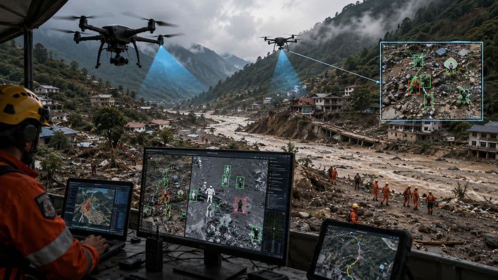
The Nepal Drone Association mobilized more than 50 pilots within a day of the flood, flying thermal cameras and LiDAR over the affected districts under an agreement it had already reached with the National Disaster Risk Reduction and Management Authority back in July. That's the hard part solved: getting cameras into terrain too dangerous and too remote for ground teams to cover on foot.
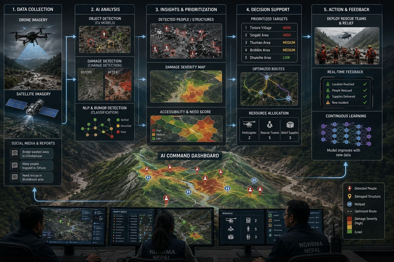
What isn't solved yet is what happens to that footage afterward. Right now, people are reviewing hours of raw video under enormous time pressure, looking for a person or a collapsed structure in debris-choked, unstable terrain. Computer vision models trained specifically for this exist. A 2024 study built a real-time rescue-target detector for exactly this use case: UAV imagery from flood zones, flagging human shapes and structural voids automatically. Running that kind of model over the association's footage as it comes in wouldn't replace the pilots or the ground teams. It would turn hours of manual scanning into a short list of coordinates worth checking first. In a valley with roads down and helicopters grounded, those are hours that matter.
The damage map is already half built. It just isn't unified yet.
Nepal's disaster authority has already used Planet Labs satellite imagery to confirm that a landslide of ice and rock triggered the flood in the Lhende River. Meanwhile, journalists at outlets like CNN are manually comparing before-and-after satellite images of Timure village to show people the scale of what happened.
This is the exact workflow the UN's Rapid Mapping Service was built to automate. It's a joint project between UNITAR, UNOSAT, and UN Global Pulse that applies AI to satellite imagery specifically to map flood, earthquake, and landslide damage fast enough to be useful to people making decisions on the ground. It has a track record: it was used to track flooding and guide aid delivery after Cyclone Eloise hit Mozambique in 2021. There's nothing stopping the same pipeline from being pointed at the Bhotekoshi-Trishuli corridor right now, producing one continuously updated map instead of scattered before-and-after image pairs published by whichever outlet gets there first.
Getting aid to the right village first is a problem someone else has already solved.
After Hurricanes Helene and Milton hit the US in 2024, the nonprofit GiveDirectly used an AI tool built by Google to figure out which specific areas combined the worst storm damage with the highest existing poverty, then sent cash relief to those households within days. That was faster than a standard manual needs assessment would have allowed.
The Rasuwa-Nuwakot-Dhading corridor has the same shape of problem. Multiple districts hit at once. Some roads and bridges are down, others still passable. A limited number of helicopters that has to be rationed across all of it. The same logic, damage severity combined with population data and current road-access status, turns "where do we send the next helicopter" from a judgment call made under pressure into a ranked list that updates as new information comes in.
The rumors need triage as much as the injured do.
With hundreds of people still unaccounted for, families are searching social media and messaging channels for any sign of missing relatives. That's the same environment where false reports spread fastest: a road wrongly said to be open, a person wrongly said to have been found. This isn't a new problem in disaster response. Systems like AIDR (Artificial Intelligence for Disaster Response) were built more than a decade ago to classify incoming social media posts in real time and flag clusters of repeated claims before responders or families start treating them as fact.
Applied here, it would mean a rescue coordination center isn't working off whoever posts loudest, and a family searching for someone isn't chasing a rumor that started three reposts ago.
None of this requires new infrastructure
Every tool described above is already running somewhere in the world, on a real disaster, right now. What's missing in Rasuwa isn't the technology. It's someone deciding to point it at this valley today, instead of writing the retrospective about it next year.
Rescue teams are still out there looking. Families are still waiting for news. This is not the time for another pilot program. It's the time to use what already works.
What AI Can Do for Nepal's Flood Relief, Starting This Week
More than 170 people are confirmed dead in Nepal's floods, with rescue still underway. Here's what AI could do on this exact disaster, starting this week.